
eSA2 GNSS Receiver
Portable Smart Antenna The eSurvey eSA2 is an easy-to-use, wearable, portable smart antenna…
Written quote within one business hour. No obligation, no spam.
Prefer to try it first? Ask about short-term hire.
About the eSA2 GNSS Receiver.
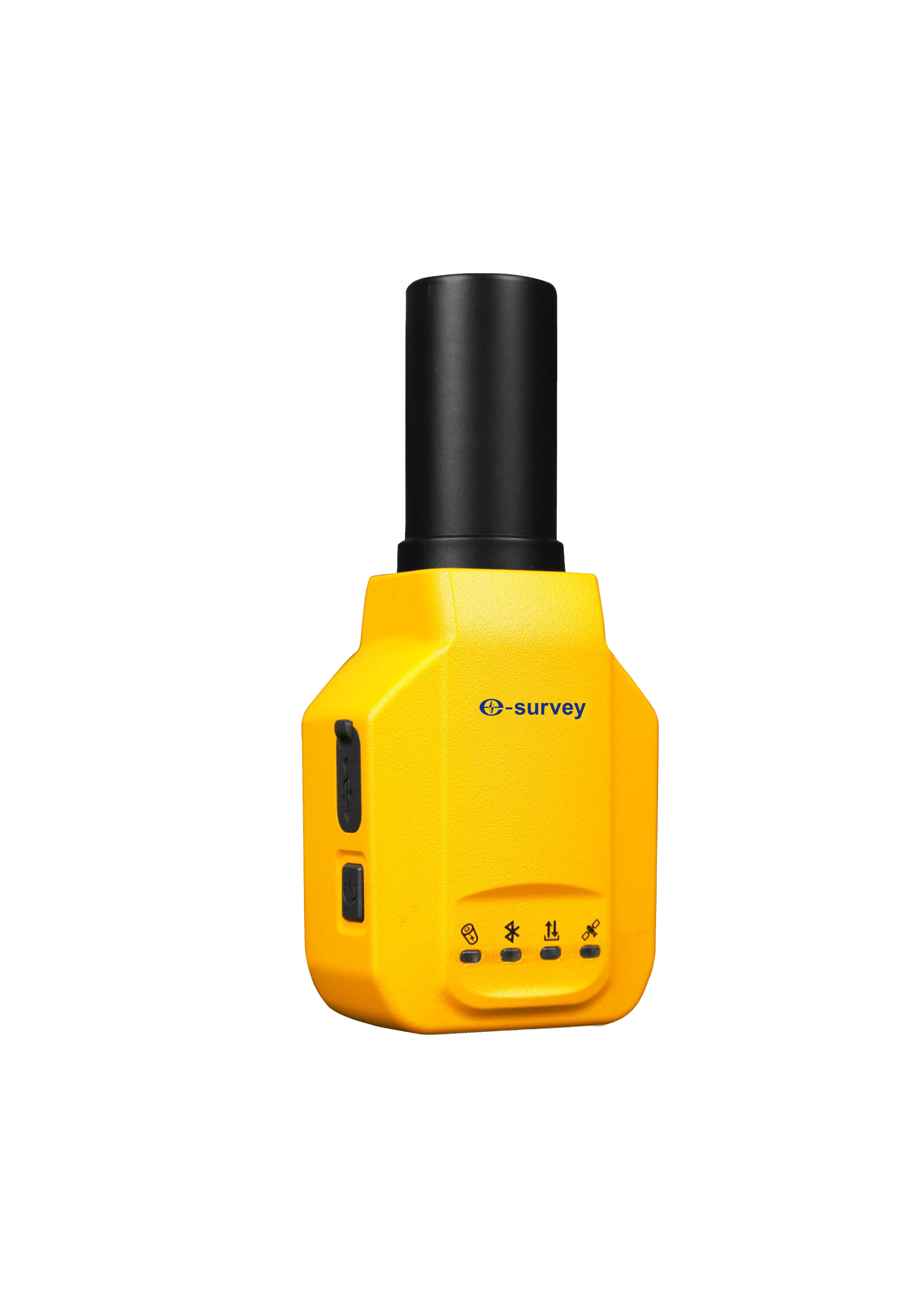
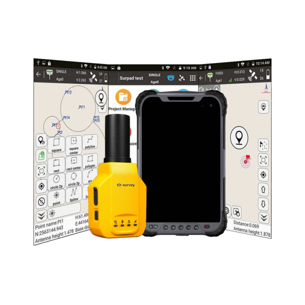
The eSurvey eSA2 is a compact, wearable smart-antenna GNSS receiver that turns an ordinary Android phone or tablet into a professional, centimetre-accurate survey and GIS tool. At just 210 g in a rugged metal-shelled IP67 body, it can be worn in an armband bag, slipped into a pocket or pole-mounted, ideal for mobile mapping where carrying a full data collector is impractical.
It tracks 1,408 channels across all major constellations, including full BeiDou-3, connects to the field device by Bluetooth, and supports tilt-compensated measurement up to 110 degrees. A lightweight, low-cost route to high-accuracy positioning.
Built to make the job faster.
Wearable design
At 210 g or less in a metal shell, the eSA2 can be worn on an armband, carried in a pocket or pole-mounted for flexible, fatigue-free surveying.
Turns any phone into a survey tool
Built-in Bluetooth pairs the eSA2 with Android devices, removing the need for a heavy, expensive dedicated data collector.
110 degree tilt survey
Tilt compensation up to 110 degrees lets you measure accurate points while standing or walking, with no pole levelling.
Full-constellation tracking
1,408 channels track GPS, GLONASS, Galileo, BeiDou (full BDS-3) and QZSS plus SBAS for fast, reliable centimetre positioning.
CORS centimetre accuracy
A high-precision GNSS module delivers centimetre positioning from CORS corrections, with RTK accuracy of H 2 cm + 1 ppm.
Rugged, all-day capable
IP67 sealing, a 1.6 m drop rating and a battery giving 10 hours or more keep it dependable for a full day.
The full detail.
GNSS
- Channels
- 1,408
- Constellations
- GPS, GLONASS, Galileo, BeiDou (full BDS-3), QZSS, SBAS
- Initialisation
- Under 5 seconds typical
- Cold start
- Under 30 seconds
Positioning Accuracy
- RTK
- H 2 cm + 1 ppm, V 3 cm + 1 ppm
- Single point
- H 1.5 m, V 2.5 m
- Tilt
- Tilt survey up to 110 degrees
Communication
- Bluetooth
- Built-in, pairs with Android devices
- Data port
- USB Type-C
- Corrections
- Via the paired device (CORS / NTRIP)
Physical & Electrical
- Dimensions
- 118 x 52 x 36 mm
- Weight
- 210 g or less
- Battery
- 1,800 mAh Li-polymer
- Working time
- 10 hours or more
- Protection
- IP67
- Operating temperature
- -20 to +75 degC
- Drop rating
- 1.6 m free drop
Specifications are sourced from the manufacturer and may vary by configuration or firmware. Full datasheets available on request.
Where it earns its keep.
- 01 GIS data collection and asset mapping
- 02 Road construction surveying
- 03 Power line and utility surveying
- 04 Site levelling and grade control
- 05 CAD and mapping field capture
- 06 General survey and stakeout tasks
Backed by GeoSurv Africa.
The kit is only half of it. Every instrument we supply is backed by our own service centre and a team that knows the gear.
In-house service centre
Calibration, repair and accuracy testing for most professional brands.
Honest, project-led advice
We match the kit to your accuracy needs and budget, no upselling.
Real local support
Phone, email or WhatsApp a person who actually knows the gear.
Equipment hire available
Cover project peaks or service downtime with short-term hire.
More in E-Survey Products
E300pro GNSS Receiver
The eSurvey E300 Pro is a fully functional GNSS receiver with an extremely compact design…

E500 GNSS Receiver
The eSurvey E500 is manufactured for improved performance in complex GNSS conditions
E800 GNSS Receiver
The E800 is a high-performance GNSS receiver that provides an easy-to-use solution for…